Cartography Project for Kids
Maps may tell us how to get from point A to point B, but they can also spark imagination, sharpen minds, and open up a world of discovery. In this hands-on mapping project, students become real-world explorers and mapmakers, learning how to decode symbols, measure distances, and navigate using cardinal directions. But it’s more than just a geography lesson, mapping has cross-curricular tie ins to math and social studies, while also building skills in spatial awareness, critical thinking, and even storytelling. Whether students are charting a treasure map, designing their dream town, or mapping their classroom, they’re developing a deeper understanding of how we relate to the spaces around us. Best of all, this project is adaptable for any learning space, from classrooms and homeschool spaces to summer camps and clubs.
How to Read a Map? A Cartography and Mapping Project
Table of Contents

Disclaimer: This article may contain commission, paid partnerships, or affiliate links. We independently review everything we recommend. When you buy through our links, we may earn a commission from qualifying purchases.
In this lesson, your students will step into the shoes of real cartographers. They’ll learn how to interpret symbols and scales, navigate using cardinal directions, and design their own maps. Along the way, they’ll practice measuring distances, thinking spatially, and understanding how communities are connected. Whether you’re guiding a classroom treasure hunt, mapping the school grounds, or exploring how different types of maps reveal patterns in our environment, this project makes learning hands-on and memorable.
What is Cartography?
Cartography is the art of making maps. People who do cartography are called cartographers, and they help us find our way by drawing places, roads, rivers, and more!
What is Orienteering?
Orienteering is like a fun treasure hunt where you use a map and a compass to find your way through places like forests or parks or on an island where a large treasure lies.
Why Learn Mapping in a Digital World?
OK, let’s address the elephant in the room. Why would anyone need to learn how to read a map when we have apps like Google Maps? In today’s world, it’s easy to wonder why learning to read and make maps still matters. But mapping and cartography build skills that go far beyond simply finding directions.
When kids learn how to create and interpret maps, they are strengthening their spatial thinking which is the ability to understand where things are and how they relate to one another. This helps with everything from solving math problems to organizing ideas.
Mapping also reinforces math concepts like measurement, scale, and proportion. Kids learn to calculate distances and compare sizes while creating something meaningful.
Reading and making maps develops critical thinking and problem-solving skills, too. Students must analyze information, plan routes, and make decisions about what to include and how to present it clearly.
Finally, cartography builds global awareness and creativity. Kids discover how people and places connect and can design their own maps of real or imaginary worlds.
Even in a digital age, these lessons help children become confident, curious explorers with a better understanding of their world and their place within it.
Getting Started with Paper Maps
Even though paper maps aren’t used as much today, reading maps is still a fun and useful skill!
A good place to start is with simple maps of their immediate surroundings like the town they live in, their classroom, or even their playground. Discuss where things are and how they connect and when they get the hang of it you can get them to make other types of maps.
Before we start making maps, there are some important things we need to know about map making. These things help us to read and understand maps easily:
Cardinal Direction
North, east, south and west are the four cardinal directions, often marked by the initials N, E, S and W.
These four directions are on any type of compass. On a map, you will find a compass rose which always has all four directions N (North), E (East), S (South) and W (West) and sometimes NE (North-West), SE (South-East), SW (South-West) and NW (North-West) too. They are found in between the four cardinal directions.

There is a special way to remember the order of the four cardinal directions. It is called a Mnemonic Device (a fun play on words), and it looks like this:
NEVER EAT SOGGY WAFFLES! – N, E, S, W
TODALS
Good maps always have the six TODALS that help us read and understand maps.
T is for Title or the name of the map. It tells what the map is about.
O is for Orientation. It shows us which way is north, so you know how to hold or read the map correctly. On the top right-hand corner of the map in the video is a compass rose, so you can see where North is facing.
D is for the Date on the map. This tells us when the map was made.
A is for the Author of the map. This tells us who made the map.
L is for the Legend (Key). The legend or key explains what the symbols, lines, or colors on the map mean.

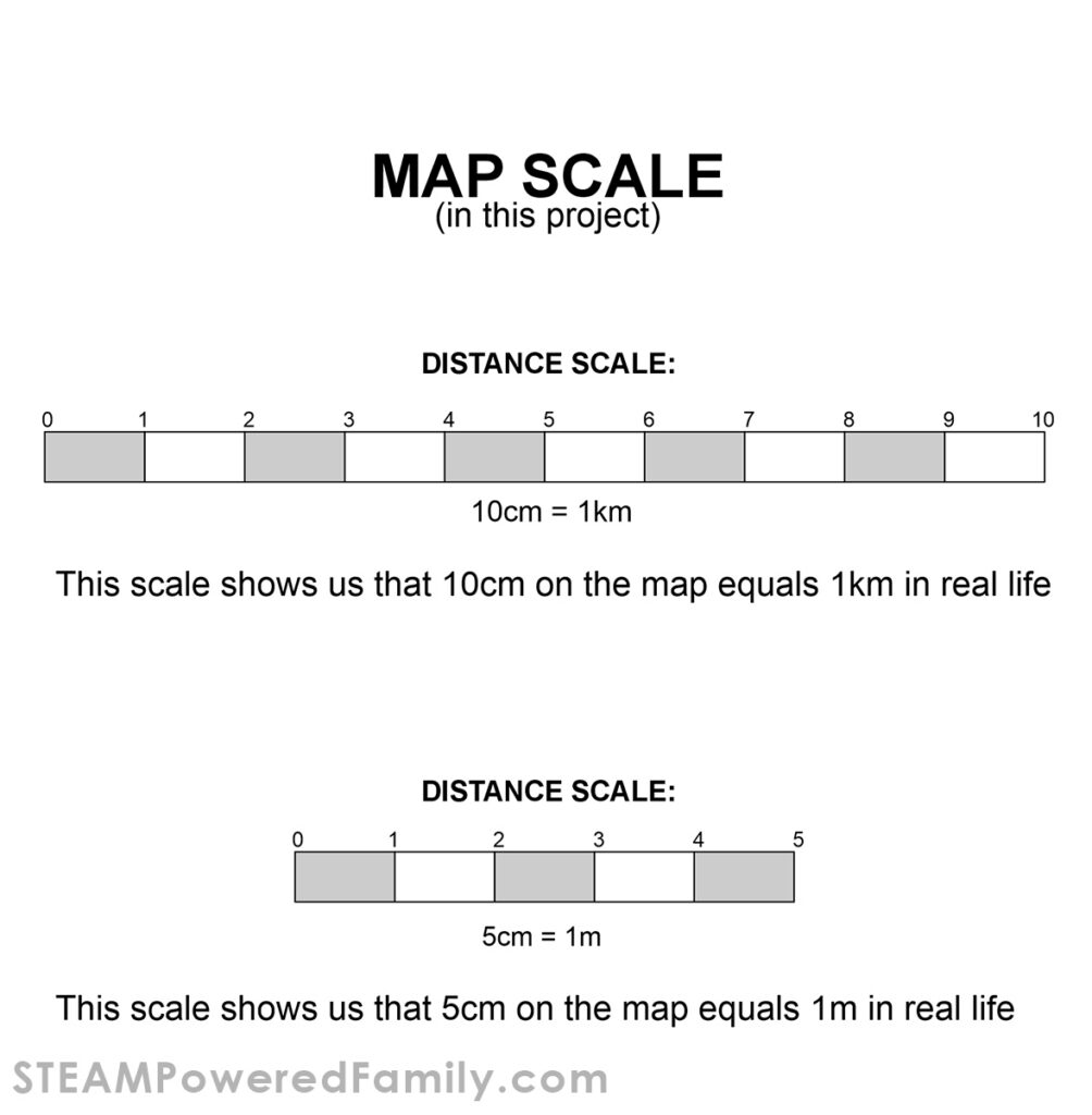
S is for the Scale. The scale shows us how big things are on the map compared to the real world. On the map used in the video, the scale is 10cm = 1km. this means that every 10cm on this tiny map is equal to 1km in real life.
Different types of Maps
There are so many different types of maps to demonstrate different types of information. Some examples include:
- Political Map – On a map of a specific country, it will show all that country’s provinces, cities, borders, and important towns, like its capital. These maps help kids see how land is divided into areas that people govern.
- Physical Map – On a physical map it shows all the different landforms like mountains, rivers, lakes, deserts, and valleys. It shows what the land looks like in different places.
- Climate Map – These maps show weather patterns such as rainfall, temperature, or climate zones. It helps us understand why some places are hot, cold, wet, or dry.
- Resource / Economic Map – These maps show us all the natural resources of an area and how the land is used for farming, mining, forests, etc. It shows us what people produce or gather in different areas.
- Road / Transportation Map – This map shows highways, main roads, railways, and airports in a specific place. It helps us see how people travel from one place to another.
- Topographic Map – This map shows the shape of the land using contour lines (shows hills, valleys, and elevation). It helps us see how flat or hilly a place is.
- Thematic Map – This map shows us a special theme like population, languages, or animals. This map shows us where different animals live, what languages are spoken in that area and how many people live in that area.
- Treasure Maps – These maps send you on a goose chase in a specific area to find a treasure, just like the pirates did many, many years ago!
Cartography and Mapping Lesson
Materials
Scissors
Glue stick
Pencil
Ruler
Mapping Lesson Printable
We have created a printable template pack that also includes a worksheet for your lesson planning. Enter your email in the form to unlock the printable.
Directions
Cut out all the pieces for the map. Cut on the outside border of each piece.
Place the map template and all the pieces next to the template.
Students can follow the tutorial or make a different town with all the pieces.
Write down all the street names. There will be a total of 5 street names.
Do not glue the pieces down until the students are happy with their layout. As the final step, have students color the map.
Mapping Worksheet
Once the maps are complete, students can reinforce lessons by completing the worksheet included with the templates. They will need a ruler and a pencil to calculate some of the answers, using the scale at the bottom of the map. The other questions just need a little common sense, and the use of the compass rose in the top right corner of the template and the KEY down the right side of the template.
Extension Activities
Take this project to the next level by having your kids create a large, 3D version of your map! Use cardboard and recycled materials to make all the buildings and features of your map to really bring it alive. Then you can challenge your kids to drive remote control cars through their cities following a map, or bring in some coding and program a robot to navigate the city.

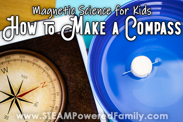
A brilliant project to link to this one is to make your own compass and learn how an actual compass works.
Other mapping projects can include following a treasure map for a summer camp outdoor project, or a fun back-to-school concept would be to do a mapping project in the classroom as a way for kids to learn where things are in their classroom and school.
Have fun mapping and learning!